Whernside Summit

Explore One of the Mountains in the UK: Whernside Guide

Yorkshire Dales National Park
736m Height (2415ft)
Moderate Difficulty
54.2297°N, 2.4208°W

Introduction to Whernside

Whernside is one of the notable mountains in the UK, known for its unique landscape, scenic routes, and natural beauty. Whether you're searching for popular mountains to climb UK, planning your first summit, or exploring the best mountains to climb UK, this guide covers everything you need to know to plan your adventure.

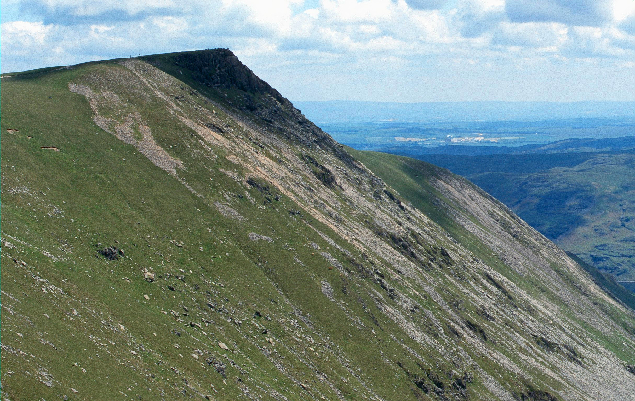
Whernside is the highest of the Yorkshire Three Peaks. The walk along the ridge from Ribblehead Viaduct is spectacular, with panoramic views.

Key Mountain Facts & Map

Location & Map

Map showing location of Whernside
Region:
England, North Yorkshire
OS Grid Reference:
SD 738814

Weather & Conditions

Mountain weather can change rapidly and dramatically. Always check the forecast before setting out and be prepared for conditions to be significantly different at the summit compared to the base.

Weather Tips:

  • Summit temperatures are typically 5-10°C colder than valley floor
  • Wind chill can make it feel significantly colder
  • Visibility can drop to near zero in mist or cloud
  • Always carry waterproofs, warm layers, and emergency shelter
  • Be prepared to turn back if conditions deteriorate

Parking & Access

Plan your arrival early, especially on weekends and during peak season, as car parks fill quickly. Always check parking restrictions and fees before you travel.

Parking Tips:

  • Arrive before 9am on busy days to secure parking
  • Have coins/card ready for pay-and-display machines
  • Don't leave valuables visible in your vehicle
  • Park considerately and don't block access roads
  • Note your parking location for your return
Emergency: 999 or 112 (Ask for Police, then Mountain Rescue)

Safety Tips for Climbing Whernside

Stay safe while climbing one of the mountains in the UK with these essential safety guidelines:

Weather Preparation

Always check weather forecasts before setting out. Mountain weather can change rapidly, and summit conditions are typically 5-10°C colder than valley floor with significant wind chill.

Essential Equipment

Carry maps, compass or GPS, water, food, first aid kit, whistle, torch, emergency shelter, and appropriate clothing layers including waterproofs.

Route Planning

Let someone know your route plan and expected return time. Stick to marked paths and be prepared to turn back if conditions deteriorate.

Emergency Contact

In case of emergency, dial 999 or 112 and ask for Police, then Mountain Rescue. Know your location using grid reference or GPS coordinates.

Reviews & Community Insights

Share your experience of climbing Whernside!

Reviews and ratings coming soon.

Frequently Asked Questions About Whernside

Is Whernside one of the best mountains to climb UK?

Yes, Whernside is considered one of the best mountains to climb in the UK thanks to its scenic routes, 736m elevation, and moderate difficulty level, making it accessible to various skill levels.

What level of difficulty is Whernside?

Whernside has a difficulty rating of Moderate. The mountain offers various routes suitable for different experience levels.

Where can I see Whernside on a map?

You can view Whernside on our interactive map showing its location in England, North Yorkshire. The mountain is positioned at coordinates 54.2297°N, 2.4208°W, with detailed route maps and nearby geographical features.

Are there family-friendly routes on Whernside?

Route suitability depends on experience level, weather conditions, and your group's capabilities. Some routes may be suitable for families with older children who have hillwalking experience. Always assess your group's abilities and check current conditions before setting out.

When is the best time to climb Whernside?

The best season to climb Whernside is Spring to Autumn. Weather conditions can vary significantly throughout the year, so always check the forecast before your visit and be prepared for changing mountain weather. Summit temperatures are typically 5-10°C colder than valley floor, and wind chill can make it feel significantly colder.