Sgurr na Banachdich
About Sgurr na Banachdich
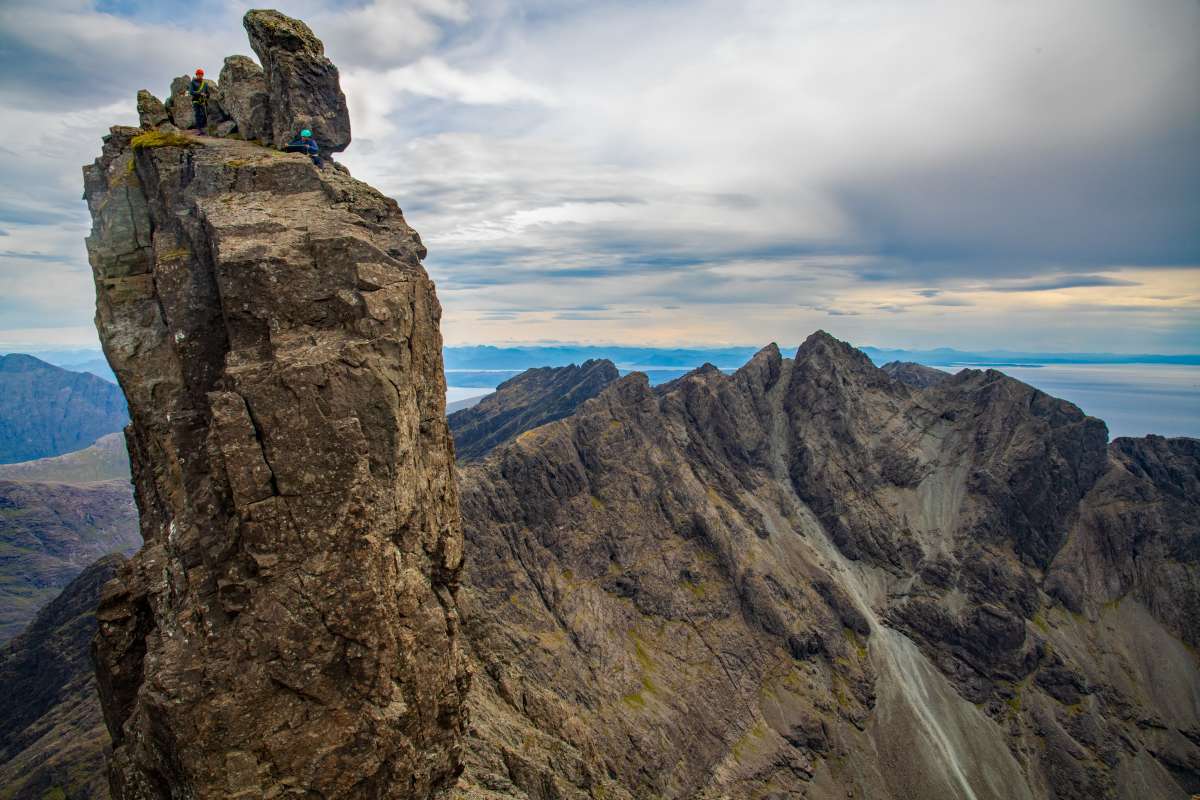
Sgurr na Banachdich is one of the Cuillin Ridge Munros on Skye, the most technically demanding mountain range in Britain. The peak provides extraordinary views over the Cuillin horseshoe.
Height & Prominence of Sgurr na Banachdich
Sgurr na Banachdich stands at 965 metres (3165 feet) above sea level, according to Ordnance Survey data. Its topographic prominence is 215 metres, meaning it rises at least that far above the col connecting it to the nearest higher peak. Sgurr na Banachdich is part of the Cuillin Ridge. The OS grid reference is NG 440228, which you can use to locate the summit on any Ordnance Survey Explorer or Landranger map.
Sgurr na Banachdich carries the classification of Munro. As a Munro, it is one of Scotland's 282 summits over 3,000 ft (914.4 m), as originally catalogued by Sir Hugh Munro in 1891.
Location & Nearest Towns
Sgurr na Banachdich is located in Scotland, Highland. It sits in the Isle of Skye area. The nearest towns and villages include Glenbrittle, Loch Coruisk, Sgurr Dearg, where you can find accommodation, pubs, and supplies before or after your walk.
For official access information and any seasonal restrictions, check the relevant national park authority.

Interesting Facts
- One of the few 'relatively' accessible Cuillin Munros
- The Cuillin Ridge is the hardest mountain terrain in Britain
- Requires basic scrambling to reach the summit safely
Safety Tips
Always check forecasts before setting out. Summit conditions differ dramatically from valley level.
Carry map, compass/GPS, water, food, first aid, whistle, torch, and waterproofs.
Tell someone your route and return time. Stick to marked paths. Be ready to turn back.
Ask for Police, then Mountain Rescue. Know your grid reference.
On the Mountain: Walking Sgurr na Banachdich
Sgurr na Banachdich is a hard walk that rewards careful planning. The summit sits at 965m, where conditions can feel distinctly different from the valley — wind speeds are typically 30–50% stronger above 800m, and the temperature drops roughly 1°C for every 100m of ascent. In cloud, the cairn at the top can be hard to spot, so keep a map and compass to hand even on well-marked paths.
After your walk, the nearest village — Glenbrittle — is a good place for a pint and a debrief. For detailed route descriptions and trip reports from other walkers, Walkhighlands is an excellent resource.
Nearby Dining
- Sligachan Hotel
- Old Inn, Carbost
Frequently Asked Questions
Is Sgurr na Banachdich one of the best mountains to climb in the UK?
Yes, Sgurr na Banachdich is considered one of the best mountains to climb in the UK thanks to its scenic routes, 965m elevation, and hard difficulty level.
What difficulty level is Sgurr na Banachdich?
Sgurr na Banachdich has a difficulty rating of Hard. Various routes are available for different experience levels.
When is the best time to climb Sgurr na Banachdich?
The best season is Spring to Autumn. Summit temperatures are typically 5–10°C colder than the valley, and conditions can change rapidly.
Why Visit Sgurr na Banachdich?
Sgurr na Banachdich stands at 965m (3165ft) in Scotland, Highland. Classified as a Munro, it is a rewarding destination for hikers, climbers, and photographers.
Browse our UK mountains directory to discover more peaks, or see all mountains A–Z.
Nearby Peaks to Explore
Looking beyond Sgurr na Banachdich? These peaks are close by and worth exploring.