Cairngorm Mountain Height: Facts About Cairn Gorm's Summit
Key Takeaways
- Cairngorm mountain height is 1,245m (4,085 ft), Scotland's 6th-highest peak.
- Despite giving its name to the whole Cairngorms range, Cairn Gorm is not the highest mountain in the Cairngorms — that title belongs to Ben Macdui at 1,309m.
- Home to the Cairngorm Mountain ski resort and a funicular railway.
- Recorded the UK's highest-ever official wind gust: 173mph in 1986.
About Cairn Gorm
Cairn Gorm (1,245m) is one of the best-known summits in the Cairngorms National Park, home to the UK's highest funicular railway and a busy ski centre. Despite its fame, Cairn Gorm is not the highest peak in the Cairngorms — that title belongs to Ben Macdui (1,309m), the second-highest mountain in the UK, which sits roughly 5 km to the south-west. Cairn Gorm is, however, the sixth-highest mountain in the UK and a popular day out for hillwalkers, skiers, and winter climbers alike.
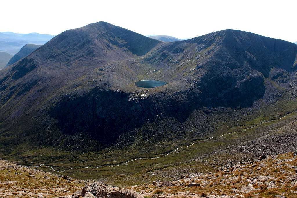
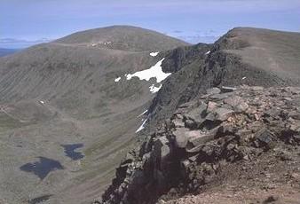
Cairn Gorm rises dramatically above Aviemore and the Strathspey valley, its northern flanks carved into a series of corries that hold snow well into spring. The mountain's funicular railway, opened in 2001, runs from the Base Station at 637m to the Ptarmigan Station at 1,097m, giving visitors a taste of the high plateau without the climb — though walkers heading for the true summit still need to complete the final 150m on foot.
The summit of Cairn Gorm sits on the western edge of the Cairngorm Plateau, a vast arctic-alpine landscape that is one of the wildest areas in the British Isles. The plateau is home to rare wildlife including ptarmigan, mountain hare, and the UK's only herd of reindeer, reintroduced in 1952. The plateau's sheer size means navigation can be challenging in poor visibility, and walkers should carry a map and compass even on seemingly straightforward summer days.
It is a common misconception that Cairn Gorm is the highest mountain in the Cairngorms. That distinction belongs to Ben Macdui (1,309m), the second-highest mountain in the UK, approximately 5 km south-west of Cairn Gorm's summit. The Cairngorm range also contains Braeriach (1,296m), Cairn Toul (1,291m), and Sgor an Lochain Uaine (1,258m), all of which are higher than or comparable to Cairn Gorm itself. The range gets its name from An Càrn Gorm ('the blue-grey hill' in Gaelic), referring specifically to this peak.
In winter, Cairn Gorm is Scotland's busiest ski resort, with 22 runs and a vertical drop of 470m served by the funicular and several chairlifts. The Coire na Sgreuchaill and Coire Cas areas offer the most reliable snow, though conditions vary enormously from year to year. Winter climbers also flock to the northern corries — particularly Coire an t-Sneachda and Coire Domhain — for ice and mixed routes that form reliably from December to March.
For summer walkers, the most popular route to the summit starts from the Coire Cas car park and follows the path through the ski area to the top, a round trip of roughly 8 km taking 3–4 hours. For a quieter experience, the approach via the Lairig Ghru pass from the south offers a longer and more remote feel. Always check the Mountain Weather Information Service forecast before setting out, as the plateau can be dangerously icy in winter and surprisingly cold even in midsummer.
Height & Prominence of Cairn Gorm
Cairn Gorm stands at 1245 metres (4084 feet) above sea level, according to Ordnance Survey data. Its topographic prominence is 146 metres, meaning it rises at least that far above the col connecting it to the nearest higher peak. Cairn Gorm is part of the Cairngorms, Grampian Mountains. The OS grid reference is NJ 005 040, which you can use to locate the summit on any Ordnance Survey Explorer or Landranger map.
Cairn Gorm carries the classification of Munro. As a Munro, it is one of Scotland's 282 summits over 3,000 ft (914.4 m), as originally catalogued by Sir Hugh Munro in 1891.
Location & Nearest Towns
Cairn Gorm is located in Scotland, Highland, within Cairngorms National Park. It sits in the Cairngorms National Park area. The nearest towns and villages include Aviemore, Loch Morlich, Ben Macdui, and others, where you can find accommodation, pubs, and supplies before or after your walk.
For sat-nav, use postcode PH22 1RB to reach the main parking area.
For official access information and any seasonal restrictions, check the Cairngorms National Park authority.

Interesting Facts
- Gave its name to the Cairngorms range
- Home to Scotland's only funicular railway
- Popular ski resort in winter
- Summit plateau is arctic-alpine environment
- One of five Scottish 4000-foot mountains
Walking Guide
The most popular route to the summit of Cairn Gorm starts from the Coire Cas car park at the foot of the ski area, near Aviemore. The path climbs north-west through the ski developments, passing the Ptarmigan Station at 1,097m before continuing to the true summit at 1,245m - a round trip of roughly 8 km taking 3-4 hours for fit walkers. For a quieter and more scenic approach, the Windy Ridge Path follows the north-western ridge from the same car park, avoiding the ski infrastructure and offering fine views across the Cairngorm Plateau. In winter, Cairn Gorm becomes Scotland's busiest ski resort with 22 runs served by the funicular and chairlifts, and the northern corries - particularly Coire an t-Sneachda and Coire Domhain - are renowned for ice and mixed climbing from December to March. The summit sits on the edge of the Cairngorm Plateau, a vast arctic-alpine landscape and one of the wildest areas in the British Isles; navigation can be challenging in poor visibility, so always carry a map and compass. Check the Mountain Weather Information Service forecast before setting out, as the plateau can be dangerously icy in winter and surprisingly cold even in midsummer.
Hiking Routes
Choose a route based on your experience and fitness level.
Windy Ridge Path
EasyThe standard walking route to the summit, following a well-built path from the ski centre car park past the Ptarmigan Station. Stone-pitched path with handrail sections near the top; well-maintained but exposed to wind.
Becomes a genuine winter hillwalk once snow and ice arrive — microspikes or crampons are often needed on the upper path.
Northern Corries Ridge (via Fiacaill a' Choire Chais)
HardA longer, more scenic circuit tracing the rim of the Northern Corries before finishing on Cairn Gorm's summit. The connecting Fiacaill Coire an t-Sneachda ridge is a popular Grade 1 scramble for those wanting an extra challenge.
Serious winter mountaineering terrain — cornices form along the corrie edges. Full winter kit and experience essential.
Safety Tips
Always check forecasts before setting out. Summit conditions differ dramatically from valley level.
Carry map, compass/GPS, water, food, first aid, whistle, torch, and waterproofs.
Tell someone your route and return time. Stick to marked paths. Be ready to turn back.
Ask for Police, then Mountain Rescue. Know your grid reference.
On the Mountain: Walking Cairn Gorm
Cairn Gorm is a moderate walk that rewards careful planning. The summit sits at 1245m, where conditions can feel distinctly different from the valley — wind speeds are typically 30–50% stronger above 800m, and the temperature drops roughly 1°C for every 100m of ascent. In cloud, the cairn at the top can be hard to spot, so keep a map and compass to hand even on well-marked paths.
After your walk, the nearest village — Aviemore — is a good place for a pint and a debrief. For detailed route descriptions and trip reports from other walkers, Walkhighlands is an excellent resource.
Nearby Dining
- Ptarmigan Restaurant
- Cas Bar
- Base Station Cafe
Frequently Asked Questions
Is Cairn Gorm one of the best mountains to climb in the UK?
Yes, Cairn Gorm is considered one of the best mountains to climb in the UK thanks to its scenic routes, 1245m elevation, and moderate difficulty level.
What difficulty level is Cairn Gorm?
Cairn Gorm has a difficulty rating of Moderate. There are 2 documented routes to choose from.
When is the best time to climb Cairn Gorm?
The best season is May to September. Summit temperatures are typically 5–10°C colder than the valley, and conditions can change rapidly.
Where should I park for Cairn Gorm?
Use postcode PH22 1RB for sat-nav. Arrive early on weekends — car parks fill quickly during peak season.
How high is Cairngorm mountain?
Cairn Gorm stands at 1,245m (4,085 ft) at its summit, making it the sixth-highest mountain in Scotland.
Is Cairn Gorm the same as the Cairngorms?
No. Cairn Gorm is one mountain; the Cairngorms is the wider range of peaks — including Ben Macdui, Braeriach and Cairn Toul — that takes its name from Cairn Gorm.
Which is the highest mountain in the Cairngorms National Park?
Ben Macdui, at 1,309m — not Cairn Gorm. Despite giving its name to the range, Cairn Gorm is only the fourth-highest summit in the Cairngorms.
Can I get to the Cairn Gorm summit by funicular?
The funicular takes you as far as the Ptarmigan Station (1,097m), leaving a short walk to the true summit — it doesn't run directly to the top. The railway has also had repeated multi-month and multi-year closures for structural repairs since 2018, so check Cairngorm Mountain's live status before basing a visit around it; the walking routes are unaffected by funicular closures.
Why Visit Cairn Gorm?
Cairn Gorm stands at 1245m (4084ft) in Scotland, Highland. Classified as a Munro, it is a rewarding destination for hikers, climbers, and photographers. Known for its funicular railway and winter ski resort.
Browse our UK mountains directory to discover more peaks, or see all mountains A–Z.
Nearby Peaks to Explore
Looking beyond Cairn Gorm? These peaks are close by and worth exploring.