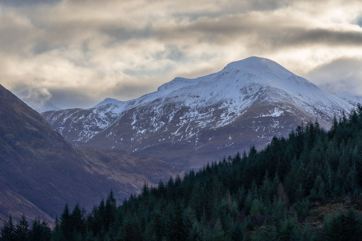
Ben Nevis Route & Hiking Guide: Complete Walk-Up
Ben Nevis is the highest mountain in the United Kingdom, standing at 1,345 metres (4,413 feet) above sea level in the Scottish Highlands. Whether you are a first-time walker or an experienced mountaineer, the Ben Nevis mountain track offers a challenging but achievable route to the summit of Britain’s tallest peak. This guide covers every aspect of planning your ascent, from choosing the right Ben Nevis track to understanding the terrain, weather, and safety considerations that come with climbing one of the tallest mountains in the UK.
Where Is Ben Nevis and How to Get There
The question "where is Ben Nevis" is one of the most common searches for UK hikers. Ben Nevis sits in the Grampian Mountains, just outside the town of Fort William in the Scottish Highlands. The mountain range Ben Nevis belongs to is known as the Nevis Range, part of the broader Lochaber area. Fort William is approximately a 2.5-hour drive from Glasgow via the A82, and around 3.5 hours from Edinburgh. The nearest railway station is Fort William, with direct services from Glasgow Queen Street and the famous Jacobite steam train from Mallaig.
The Ben Nevis range of mountains includes neighbouring peaks Carn Mor Dearg and Aonach Beag, making the area a popular destination for multi-peak days. If you are driving, the main starting point for the Ben Nevis Mountain Track is the Glen Nevis Visitor Centre car park, located at the foot of the mountain in Glen Nevis.
The Ben Nevis Mountain Track (Pony Track)
The Ben Nevis mountain track — also called the Pony Track — is the most popular and straightforward route to the summit. It begins at the Glen Nevis Visitor Centre and follows a well-constructed path that zigzags up the western flank of the Ben Nevis mountain. The track was originally built in the 19th century to supply the summit observatory, and it remains the standard route for the vast majority of walkers.
The total distance is approximately 17 kilometres (10.5 miles) out and back, with an elevation gain of around 1,352 metres. Most walkers complete the round trip in 5 to 7 hours, depending on fitness and weather conditions. The Ben Nevis track is graded as a moderate-to-hard walk: there are no technical climbing sections in summer, but the upper portion crosses loose stone and boulder fields that require careful footing.
For those seeking an alternative, the Carn Mor Dearg Arete route is a more challenging option that traverses a narrow ridge connecting Carn Mor Dearg to Ben Nevis. This route requires scrambling experience and should only be attempted in good weather with proper navigation skills. A detailed Ben Nevis route map is essential for any route other than the standard Mountain Track.
What to Expect on the Ben Nevis Tracks
There are several Ben Nevis tracks to be aware of. The Mountain Track (Pony Track) is the primary walking route, while the CMD Arete is the classic mountaineering route. A third option, the Ledge Route via Number Five Gully, offers a steeper but quieter approach from the north. All Ben Nevis tracks share the same summit, but they differ significantly in difficulty and exposure.
The lower section of the Mountain Track follows the Allt a’ Mhuilinn before climbing through a series of zigzags known as the “Red Burn” crossing. Above the Halfway Lochan, the path becomes steeper and more rocky. The final 200 metres of ascent cross large boulders to the summit cairn and the ruins of the old observatory. Even in summer, the summit can be cold and visibility can drop to near zero — always carry a map and compass.
Ben Nevis as One of the Tallest Mountains in the UK
Ben Nevis is the highest of the tallest mountains in UK rankings, standing at 1,345 metres. It is classified as a Munro — a Scottish mountain over 3,000 feet — and is the most prominent of the 282 Munros. The summit features the ruins of a Victorian-era observatory that operated from 1883 to 1904, along with a war memorial. For a broader perspective on where Ben Nevis sits among the tallest mountains in UK rankings, read our complete UK mountain heights and top 10 lists guide.
The Ben Nevis mountain is also notable for its dramatic east face, which contains some of the highest cliffs in the UK. These cliffs are a major destination for winter climbing, with classic routes like Point Five Gully drawing climbers from around the world. If you are interested in exploring other famous peaks, our guide to famous UK mountains and the three highest peaks covers the full trio of Ben Nevis, Snowdon, and Scafell Pike.
Planning Your Ascent: Timing and Conditions
The best time to climb Ben Nevis is between May and September, when the days are longest and the weather is most stable. However, Scottish mountain weather is notoriously unpredictable — it can snow on the summit in any month of the year. Always check the Mountain Weather Information Service before setting out.
In winter (November to April), the upper sections of Ben Nevis are regularly snow-covered and icy. Full winter equipment — crampons, ice axe, and the skills to use them — is essential. Many walkers choose to hire a qualified mountain guide for winter ascents. For a wider look at planning mountain trips across Britain, see our UK mountains overview and guide.
Ben Nevis Route Map and Navigation Tips
A Ben Nevis route map is essential even on the standard Mountain Track. In poor visibility, the summit plateau is notoriously disorienting — it spans roughly 40 hectares and is surrounded by steep cliffs on the north and east sides. The Ordnance Survey Landranger map 41 (Ben Nevis and Fort William) or the OS Explorer map 384 (Ben Nevis and Glen Coe) cover the area in detail.
Key navigation waypoints on the Mountain Track include the Glen Nevis Visitor Centre start point, the Halfway Lochan, the Red Burn crossing, and the final summit cairn. On the descent, take care to follow the cairns carefully — drifting left towards the Five Finger Gully has been the cause of several fatal accidents. Carry a compass and know how to take a bearing before you attempt the summit.
Safety, Rescue, and Conservation
Ben Nevis is a serious mountain, and rescue incidents are common. The Lochaber Mountain Rescue Team operates in the area and can be contacted via 999 (ask for Police, then Mountain Rescue). Common emergencies include navigation errors in fog, slips on icy paths, and exhaustion. Always carry a fully charged phone, a head torch, spare warm layers, food, and water.
Conservation is also important. The upper slopes of Ben Nevis are a Site of Special Scientific Interest (SSSI) and home to rare alpine plant species. Stick to established paths, carry out all litter, and avoid disturbing wildlife. The John Muir Trust and the Nevis Landscape Partnership work to maintain the paths and protect the mountain’s fragile ecology — consider supporting their work.
Frequently Asked Questions
How long does it take to climb Ben Nevis via the Mountain Track?
Most walkers complete the Ben Nevis mountain track in 5 to 7 hours round trip, depending on fitness, weather, and rest stops. Allow a full day and start early.
Do I need climbing gear for Ben Nevis?
In summer, no technical climbing gear is needed on the Mountain Track, but sturdy boots, warm layers, waterproofs, map, and compass are essential. In winter, crampons and an ice axe are required.
Is Ben Nevis the tallest mountain in the UK?
Yes, Ben Nevis at 1,345 metres (4,413 feet) is the tallest mountain in the UK. It is a Munro located near Fort William in the Scottish Highlands.
Where is Ben Nevis located?
Ben Nevis is located in the Scottish Highlands, just outside the town of Fort William. The main starting point is the Glen Nevis Visitor Centre car park.